1. Introduction
Geophysical lab is one of 6 labs consisting the energy and resources engineering department of Chonnam National University.
Geophysical prospecting lab education goals are to make students able to use their mathematics, physics and computer skills and exploit them to understand the earth interior as well as several natural phenomena through different geophysical methods.
By understanding the geophysical methods being taught in the lab and manipulating different programs, softwares and instruments related to each methods the students would acquire the ability to work in different disciplines; academics (universities and researches institutes) and professional (oil, underground water, mining, and telecommunication..).
Our field have plenty of possibilities and potentialities.
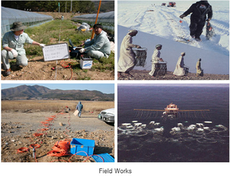
Nowadays we have a lot of opportunities to work not only in our country but also in overseas.
Research Areas
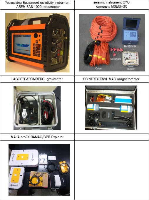
○ Gravity method : The gravity field of the Earth can be measured by timing the free fall of an object in a vacuum, by measuring the period of a pendulum, or in various other ways. it measures gravitational field’s change using the underground rock’s difference of density. It applies various field especially petroleum and gas exploration
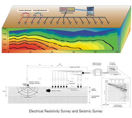
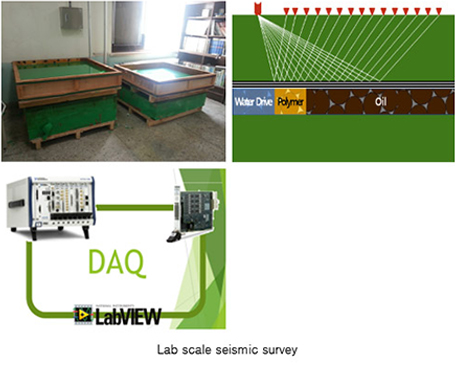
○ Seismic exploration: with our lab the student in seismic exploration is subject to enforce his background in some important theoretical and practical knowledge (field theory, wave propagation theory, computational methods in seismic ex: FDM.. ),and also to handle and manipulate some material relating to the method (computer programs, instruments).In addition the students have some advantages and facilities to enlarge their knowledges and discover most recent advances in their major throw seminar ,local and national symposiums.
○ Electrical resistivity/Electromagnetic exploration :
Each method measures how strongly a material opposes the flow of electric current and how changes electric field or magnetic field by given sources
it is also subject to enforce their background in some important theoretical and practical knowledge ( field theory, electric resistivity/
electromagnetic method like maxwell’s equation, differential equation and handle some instruments ).It is the most common technique of the Geophysical prospecting field in Korea. It can be applied in various fields(construction, geological survey, underground water survey, and resource survey, Etc)
○ Remote sensing
Remote sensing is the small or large-scale acquisition of information of an object or phenomenon, by the use of either recording or real-time sensing devices that are wireless, or not in physical or intimate contact with the object (such as by way of aircraft, spacecraft, satellite, buoy, or ship). In practice, remote sensing is the stand-off collection through the use of a variety of devices for gathering information on a given object or area. Thus, Earth observation or weather satellite collection platforms, ocean and atmospheric observing weather buoy platforms, the monitoring of a parolee via an ultrasound identification system
○ Ground Penetrating Rader survey
Ground-penetrating radar (GPR) is a geophysical method that uses radar pulses to image the subsurface. This nondestructive method uses electromagnetic radiation in the microwave band (UHF/VHF frequencies) of the radio spectrum, and detects the reflected signals from subsurface structures. GPR can be used in a variety of media, including rock, soil, ice, fresh water, pavements and structures. It can detect objects, changes in material, and voids and cracks.
Research Activities(2011~Present)
○ Post-stack Seismic attributes VS. Pre-stack Seismic Attributes in Reservoir characterization, KOGAS(KOREA GAS CORPORATION)(2011~2012)
○ Development of Enhanced Oil Recovery Technology using Novel Polymer Flooding, SK(2012~Present),
○ Electrical exploration research service, KRC(Korea Rural Community)(2013)
Contact
3A-215 Department of Engineering, Chonnam National University, Buk-ku, Gwangju, Rep of Korea
Phone : +82 62 530 1725